Border walks Lothersdale Loop | Walks
by Craven and Valley Life
 The walk takes in Lothersdale, Pinhaw Beacon, Thornton-in-Craven, a stretch of the Leeds Liverpool Canal and Earby. It is an easy walk through pleasant countryside with a spell of moderate ascent out of Earby.
Start at Lothersdale, walk down towards the village and just past the village hall, look out for a finger post on the right indicating Public Footpath Pennine Way, White Hill Lane ¾ of a mile. Take this path which leads via a walled lane to a gateway and turn left signed Pennine Way.
Continue following the Pennine Way signs crossing a minor road on to a concrete farm track and where this bends left, continue straight on through a gate.
Follow the wall on your left on to open moorland passing some grouse butts. At the junction of paths on the moor where there is a wooden post with ‘dogs not permitted’ sign, follow the main track straight ahead to the trig point at Pinhaw Beacon.
From the trig point, take one of the paths ahead. The track turns right at the corner of a wall still following Pennine Way signs and leads to a road. Carry straight on down the road until the Pennine Way bears off to the left signposted Thornton in Craven 1 ½ miles.
Over the next ladder stile keep to the wall on the right and ignore the path which forks off to the left and at first glance appears to be the main track. Follow the wall down until the Pennine Way turns right over a narrow single plank bridge then turns left to follow the wall now on your left. Head slightly left following the route of the power lines and through a kissing gate at the bottom of the field by Brown House Farm. Turn left under the old railway bridge.

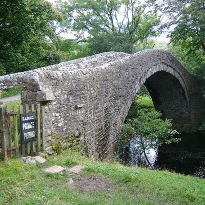
Climb the lane but as you come into Thornton-in-Craven, look out for the Pennine Way finger post on the right. The path climbs the grassy banking. Cross the main road and go up Cam Lane. Follow the footpath to the canal where you turn left leaving the Pennine Way which goes right. Walk along the canal until you reach the road and turn left. About 250 yards along the road is a finger post on the left indicating your route to Church Road ½ mile.
St Mary’s Church and go through a metal gate in the church grounds wall. To the right in the churchyard is an unusual small round stone building.
Leave the church yard by the gate into the main road. Cross the field to Thornton Hall Farm. Cross the car park and follow the footpath to Earby.
 Exit on to the main A56. Almost opposite is School Lane. Follow this past the Lead Mining Museum. Cross the beck and follow the road round between the factory buildings under the overhead ‘corridor’ between two of them and at the mini roundabout, take the second exit, Water Street. There is now a fairly lengthy trudge along this street and Stoney Bank Road which it becomes.
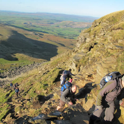
Follow the road which is more or less straight and quite steep for about ¾ of a mile until it turns a sharp right hand bend. On the bend to the left, is a short lane leading to some cottages. Take this lane for about 50 yards, ignore the gateway and footpath indicators ahead of you and turn right up a steeply sloping concrete path.
As the path opens into a steep field continue up just passing the end of a wall which juts into the field. There is a narrow stile in the stone wall straight ahead at the top. Beyond this, the path becomes a sunken lane bearing slightly to the right.
Stay on the obvious track heading towards the radio mast and this takes you to a road where you turn left towards the mast. Just before the mast, turn right where indicated by a public footpath fingerpost.
At the farm, bear slightly left and go through a gap in the collapsed wall. Go down the hill, under the power lines towards the left hand side of the next farm. Diagonally across the next field there is a stile in the wall then across the road turn right then immediately left through the farm gate. Follow the lane down past the old barn. At the next junction by the gateway to Raygill Fisheries turn left, and follow the road back into Lothersdale.